Maps have always been an important aspect of our lives. For centuries, humans have relied on maps to help them get around, find new places to explore, and learn more about their surroundings.
With the advent of technology, we now have access to countless mapping applications that can help us with all of these things and more.
As smartphone usage continues to increase, so does the demand for innovative and useful mapping apps.
Whether you’re looking for an app that can help you navigate your way around town or one that provides detailed information about specific locations, we’ve got you covered.
The next time you need directions to your next destination or want to explore an unfamiliar area, these apps are sure to meet your needs.
Read on for a comprehensive list of the top 15 best map apps.
-
Best Map Apps
- 1. Google Maps
- 2. TomTom Go
- 3. Waze
- 4. Apple Maps
- 5. Citymapper
- 6. HERE WeGo
- 7. MapQuest
- 8. AllTrails
- 9. Roadtrippers
- 10. MapOut
- 11. Navmii
- 12. CoPilot GPS
- 13. Moovit
- 14. Sygic
- 15. Scout GPS
- 16. MapFactor Navigator
- 17. Maps.me
- 18. OsmAnd
- 19. Yandex.Maps
- 20. Polaris GPS Navigation
- 21. Gaia GPS
- 22. ETA Live Traffic Alert
- 23. Traffic Spotter
- Wrap Up
Best Map Apps
1. Google Maps

Google Maps is widely considered to be the top dog in this category. With comprehensive, up-to-date data on roads, businesses, and points of interest worldwide, Google Maps makes it easy to get where you’re going.
Plus, its intuitive interface and wealth of features make it a must-have for any traveler or city dweller.
Nobody can deny the usefulness of Google Maps, which is especially good at finding nearby places and can even navigate you to your destination through driving, public transit, biking, or walking directions.
And the best part is that it works offline too! Some of its unique features include; voice navigation, traffic conditions updates, satellite images, Street View, and estimated travel times.
Google Maps is available on Android, iOs, iPad, and web browsers among others. So, if you’re in the market for a new map app, Google Maps is worth considering. It’s a free-to-download app with no in-app purchases.
Find out more apps like Google Maps.
2. TomTom Go

TomTom Go app is an incredibly accurate GPS navigator, with high-quality maps of major cities and well-designed driving directions. However, it takes a slightly different approach to navigation.
Rather than giving you turn-by-turn directions, TomTom finds your destination using your phone’s camera and then uses augmented reality to show you exactly where to go.
In addition to driving directions, TomTom Go offers public transit directions, walking directions, and street views. The app also works offline, so you can get around even when not connected to the Internet.
It’s also worth mentioning that TomTom is one of the most trusted names in mapping, so you can rest assured knowing your maps will be accurate and reliable.
TomTom Go also provides traffic condition updates and travel assistance services, making this app extremely versatile. It’s got features like 3D maps, 24/7 live traffic information, and advanced lane guidance.
TomTom Go does a great job providing a wide range of information and options.
It’s available for both Android and iOS devices. TomTom offers a 30-day trial, which is followed by a 1-month subscription for $4.99 and a 1-year subscription for $22.99.
Also Read: Best Weather Apps
3. Waze
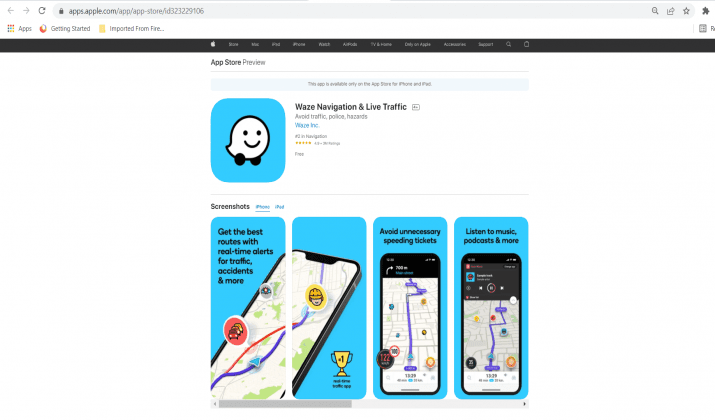
Waze is a unique mapping app that’s based on user-generated content. In addition to directions, Waze helps you find the cheapest gas prices and share real-time traffic conditions with other drivers.
The app also tells you which streets have heavy traffic, so you can avoid those areas and get to where you’re going faster.
Waze is unique because it lets you do things like report accidents, traffic jams, or speed traps. So if there’s a dangerous intersection ahead or an accident on the freeway, Waze will let you know.
And if a police officer is handing out tickets on your route, Waze will notify you of that too.
It also lets you communicate with other drivers about conditions up ahead, such as if there’s traffic congestion on your route or a better way to get where you need to go.
The app also lets you update the map yourself, so if there’s construction on your regular route, Waze will know to avoid it. Waze is accessible on both Google Play and App Store and it’s free to download and use.
Also Read: Best Mileage Tracker Apps
4. Apple Maps

When Apple Maps first came out, it was derided as one of the worst map apps ever made. However, Apple has made significant improvements to its mapping app and now stands as a decent alternative to Google Maps.
Although its maps aren’t as comprehensive, Apple Maps is useful for getting around in your immediate area. It provides directions through driving, walking, and public transit, though you’ll need to be connected to the Internet for these features to work.
Like most navigation apps, it offers turn-by-turn directions and real-time traffic updates, along with points of interest and a street view mode.
Apple Maps also integrates directly with your iPhone’s contacts, so if you’re meeting up with a friend who lives in an unfamiliar part of town, you can get directions from their address without manually typing it in.
It also offers information about the surrounding businesses and points of interest. The app is accessible on the App Store with no in-app purchases.
Apple Maps is without a doubt better than it was at its launch, but it faces stiff competition from other maps, which have surpassed it in terms of features and overall quality.
5. Citymapper

Designed for urban and suburban areas, Citymapper is an innovative and helpful app that keeps you informed about your surroundings at all times.
One of the most impressive aspects of this app is its ability to dynamically update your route according to what’s going on in the city. It does this by getting real-time data on transportation delays, disruptions, and changes.
Whether you’re in the mood for a walk or need to get somewhere fast, Citymapper effortlessly informs you of the best route at that particular moment.
The app also provides public transit directions, point-to-point walking directions, and live departure times.
It’s a free app, but there are in-app purchases. Citymapper is available for both Android and iOS devices.
Also Read: Best Mileage Tracker Apps Reviewed
6. HERE WeGo

HERE WeGo is one of the best map apps for users primarily interested in public transit information.
It provides step-by-step directions for buses, trains, and other forms of public transit, all while keeping track of any disruptions to your regular routes. HERE WeGo is more intuitive and responsive, with fewer glitches.
It provides all the information you need on a single page without clicking through multiple screens. It’s available for both Android and iPhone users.
HERE WeGo is free to download, but you’ll need a monthly subscription for voice guidance.
7. MapQuest

MapQuest is no longer as popular as it once was, but this map app still offers plenty of valuable options. It provides driving, walking, and public transit directions, which can be viewed simultaneously on the same map.
MapQuest also offers live traffic updates, turn-by-turn directions, and point-to-point navigation. If you’re looking for a map app that provides multiple ways of getting from point A to point B, then MapQuest is a good option.
The app will give you multiple route suggestions based on the time of day and traffic conditions. MapQuest is a free app with no in-app purchases for both Android and iPhone users.
Read this post to explore the best alternatives to Mapquest.
8. AllTrails

AllTrails is a map app that helps hikers and outdoor enthusiasts find and record their favorite trails. It has more than 50,000 trail maps for national parks across the country.
You can access these maps with or without an internet connection, making it a good option for outdoor activities in less populated areas.
It also features a social network for users who want to share their experiences with others.
AllTrails is free to download, but the app only offers one map for each area unless you purchase a $29 annual membership fee or a three-year plan of $59.99.
Also Read: Best Sites Like Turo
9. Roadtrippers

Roadtrippers is an app for planning trips, especially road trips. It curates lists of locations you can stop at based on your interests and location.
It also provides relevant information about each place, like reviews, admission costs, and hours of operation.
The app is free to use, but it doesn’t work without an internet connection. It features a map that’s easy to read and a clean, intuitive interface.
10. MapOut

MapOut is a map app that makes it easy to plan your next trip. It has several tools for planning out routes, gathering information about different destinations and activities, and creating a detailed itinerary.
All the information from your trips is saved in one place for easy access. You can download maps for offline use, and both the mobile app and website are free to use.
Its free version is limited to creating three trip itineraries, but you can purchase a subscription for more at a license fee of $4.99.

Initially, an offshoot of Nokia, Navmii offers a wide range of map-related features. It shows traffic jams and other disruptions on the map, providing information about alternative routes.
It also comes with a speed camera locator compatible with car DVRs. Navmii may not be as comprehensive or intuitive, but it’s a worthy alternative for people who want a map app with plenty of features.
Navmii is free to download, but you’ll need a subscription for voice guidance at $2.99. The Ad-Free version is available for $1.99.
12. CoPilot GPS

CoPilot is another option if you require a plethora of map-related features. It provides voice guidance, turn-by-turn navigation, and information about traffic, road closures, and estimated arrival times.
You can also save your favorite destinations to access them more quickly in the future.
The app works well in both urban and rural areas. CoPilot features detailed maps of more than 180 countries and regions, and you can download them straight to your device, so you don’t need to rely on an internet connection while driving.
It includes multi-stop trip planning and automatic rerouting if you miss any turns or take the wrong direction.
CoPilot offers many features that you’d expect to find in a more expensive app, but it doesn’t come cheap. All of its features are available through an in-app purchase.
Its in-app purchases range between $5.99 to $119.99 per item.
13. Moovit

Designed specifically for public transportation, Moovit is more intuitive than Citymapper, making it easier to use. It shows real-time information about departure times and disruptions to your usual routes.
Moovit also provides rider alerts, alternative routes, and station timetables. Moovit can help with directions, station info, and warnings from other travelers in your area.
Moovit provides public transit data for many cities worldwide. That’s important for those who live in cities that aren’t covered or even in places where other maps don’t include public transit routes.
If you’re interested in using public transit, then Moovit is the best app for you. It’s free to download with no in-app purchases for both Android and iOS devices.
14. Sygic

Sygic is a more expensive map app. One of its main selling points is that it offers offline maps, which means you access maps without constantly using your data.
It features many of the same things you’ll find in other navigation apps, such as lane guidance, junction views, speed limit warnings, and more. It’s also compatible with Android Auto and CarPlay.
It’s a handy app to use for those times when you can’t access the internet. If you think (don’t say) most of these features are gimmicks or not necessary, then Sygic isn’t for you.
Although it’s one of the most popular mapping apps in its niche, it doesn’t offer many unique features.
The app is free to download, but some features are limited until you upgrade to the premium version.
Prices for its in-app products are between $0.99 to $74.99 per item.
15. Scout GPS

Scout GPS Navigation is mainly designed for drivers, but it also has useful features for those who travel by bike or foot.
You can download offline maps for free, and it comes with a trip planner, route planning, and customizable data fields. The app lets you import GPX files, and it will even send you safety alerts when you approach a speed camera.
It also tracks your movement on the road, gives you directions to destinations, and tells you if there’s traffic along the way.
It can also be used as a social media platform, allowing you to instantly send your location to friends and family, so they know where you are.
One of its best features is playing audio from other apps — like audiobooks and podcasts — while still giving you voice navigation instructions.
Scout GPS Navigation is free to download, but some features are only available through an in-app purchase starting at $14.99.
Click here and scroll down the website for updated pricing.

If you want free Map apps, MapFactor Navigator is another great option. It doesn’t have the same number of features as several other maps, but it does provide turn-by-turn voice guidance.
You can also share your location with friends and family, send routes to other devices, and receive real-time road notifications.
MapFactor doesn’t come with some bells and whistles that more expensive mapping apps do, but it’s one of the best if you don’t want to spend any money.
You can download and use its limited version for free, or you can purchase a subscription for live traffic data and live gas.
In-app prices range between $0.99 to $59.99 per item.
17. Maps.me

Initially designed for travelers, Maps.me is a good choice if you don’t want to pay for map apps. It allows you to download offline maps to access them without using your data.
You can also save places on this app, share locations with friends, and get directions to different destinations. It has accurate maps of more than 70 countries, making it one of the best options for international travelers.
Maps.me is free to download, but the data you save on the app won’t be accessible if you uninstall it. Otherwise, there are no ads, no in-app purchases, and no subscription fees.
18. OsmAnd

OsmAnd is one of the best offline map apps– you can download maps for free and save them on your phone, so they’ll be accessible without an internet connection.
The free version of this app is minimal, but it can be upgraded to Pro if you want access to more features. It doesn’t offer turn-by-turn navigation, but it can provide directions to nearby places and street addresses.
You can also share places, get voice navigation, and use the app as a flashlight.
OsmAnd is free to download, but you can purchase some features like voice navigation and traffic data at an additional cost.
Visit here for updated pricing of its various paid features.
19. Yandex.Maps

Yandex.Maps is different from other map apps because it provides maps, traffic information, and routes for public transit.
It also has a feature called Places, which can provide you with more detailed information about different locations — like reviews of the restaurant and images.
You can even scan barcodes with the app to get more information.
Yandex.Maps is free to download, but if you want access to real-time traffic and live gas prices, you’ll have to purchase an in-app subscription at $2.99.

Polaris GPS Navigation is an app that helps motorists plan their routes. It’s available on Android devices for free, making it one of the best map apps for those who don’t want to spend as much as they would on a paid app.
Polaris GPS comes with essential features like voice navigation and traffic data, but it also has extras like speed limit warnings and street view images. However, the map quality isn’t as good as on more expensive apps.
21. Gaia GPS

Gaia GPS is a map app for hikers and outdoor enthusiasts. It has topographic maps and trail information you can access offline, making it great for excursions in remote areas where there’s no internet connection.
Gaia GPS also uses GPS to monitor your location as you hike, taking the guesswork out of long walks in the wilderness. You can also share your route with other people.
To download maps for offline use, you’ll need to subscribe to Gaia Pro for $39.99 a year.
22. ETA Live Traffic Alert

ETA Live Traffic Alert is a map app that helps motorists avoid traffic jams and accidents by providing up-to-the-minute information.
It uses real-time data from local traffic cameras and users to update its maps, so you can get updates on your commute even when there isn’t any internet connection.
ETA Live Traffic Alert is only available for iOS devices, and it doesn’t have voice navigation.
However, it’s free to download, and it offers a lot of useful information without any restrictions.
23. Traffic Spotter

Traffic Spotter is a free map app that offers real-time traffic updates. It also lets you report any accidents or issues on the road so that you can stay on top of traffic conditions in your area.
The app features a map with markers for accidents, construction areas, and other traffic problems.
Users power traffic updates, so the quality of information is dependent on how many people are using it in your area.
It’s a good app for those who want a mix of basic map features and real-time traffic updates.
Wrap Up
After careful consideration, it is clear that Google Maps is the best map app available. It’s been around for a long time and has consistently been updated with new features and improvements.
Plus, it integrates well with other Google products like Gmail and Drive. It also offers a wealth of features and benefits that simply cannot be beaten.
Its ease of use and comprehensiveness make it perfect for any situation, whether you’re looking for directions to the nearest coffee shop or trying to find your way around an unfamiliar city.
With Google Maps at your fingertips, you can rest assured that you’ll never lose your way again. All of that makes it the best choice for this list.
Cassie Riley has a passion for all things marketing and social media. She is a wife, mother, and entrepreneur. In her spare time, she enjoys traveling, language, music, writing, and unicorns. Cassie is a lifetime learner, and loves to spend time attending classes, webinars, and summits.